Australia So Much to See


Menindee, New South Wales - a system of lakes along the lower Darling River



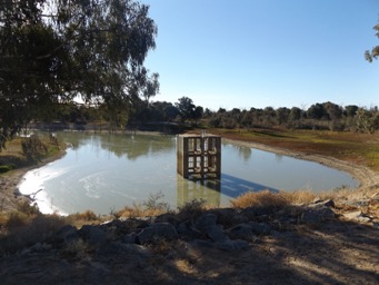
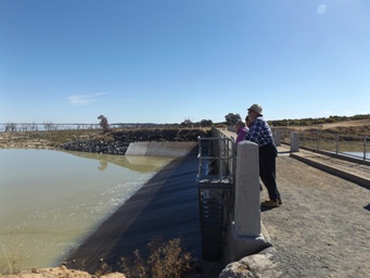
Lake Pamamaroo inlet regulator.
We then went around Lake Pamamaroo past hidden free campsites to the Copi Hollow Channel. Copi Hollow is a small lake filled from
Lake Pamamaroo, and a longer channel links to Lake Menindee. There is a small settlement here. Copi Hollow is the base
for the Broken Hill Speed Boat Club, which also has cabins for visitors and a caravan park on the shore of the lake.
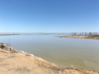
Lake Pamamaroo from the inlet regulator.
Nearby, Sunset Strip consists of houses and weekender cottages along the edge of Lake Menindee. There is also a golf course
at Sunset Strip.
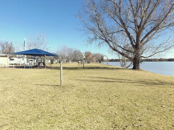
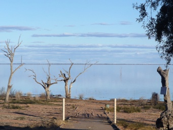
The lake is low at the Sunset Strip boat ramp.
See more of this boat ramp in different years with different water levels.
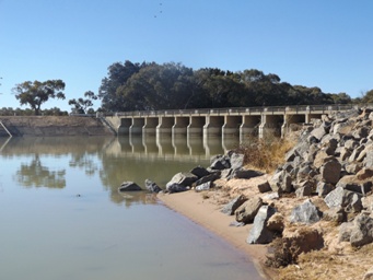
Lake Menindee Inlet Regulator and inter connecting channel to Copi Hollow. Lake Menindee is filled after Lake Pamamaroo and
Copi Hollow.
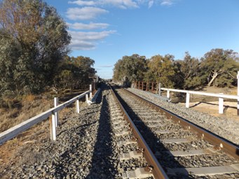
We entered the town of Menindee via a traffic bridge constructed across the Darling River in 1977. Prior to this, road traffic
shared the railway bridge (photos above) further upstream. Opened in 1927, this bridge on the main east west railway originally
had a central lift span to allow passage of river transport, but this was removed in 1970. Menindee Lakes Caravan Park is along
the shores of Lake Menindee.
Menindee is a township with a population of 980, on the shores of Lake Menindee, at an altitude of only seventy metres able sea level,
showing the low lying nature of the Darling River Floodplain and the Menindee Lakes system. There is a high percentage of Aboriginal
population in Menindee, whose culture has strong links to the Darling River and the Menindee Lakes system.
Sad to see a vineyard at Menindee dead. Increased salinity of diminishing water and lack of water after the lakes were drained have
contributed to dreams and financial security lost.
Dost Mahomet was one of the cameleers who came out from India to look after the 26 camels for the Burke and Wills Expedition. Mahomet was the only cameleer to accompany the expedition as far as Cooper Creek. After returning to Menindee from the Dig Tree,
Dost Mahomet was injured in a camel accident, which resulted in him losing the use of his arm. He stayed in Menindee and worked for
some time for William Ah Chung in the bakery. Upon his death in 1881, he was buried outside the town on the spot where he prayed every
day. A headstone has been erected and the site maintained by the Menindee and Districts Progress Association.
Horticulture around the Menindee area, such as vineyards and orchards, have utilised the lakes water supply for irrigation. Menindee
stone fruit grower Graeme Jarrett said in February 2018: “There used to be a thriving table grapes industry and other fruit growers.
But 2,500 hectares of horticulture has gone.” Increased salinity of diminishing water and lack of water after the lakes were
drained have contributed to dreams and financial security lost.
To the south west of Kinchega National Park, the irrigated
cotton farm at Lake Tandau has been converted to fat lamb production due to lack of water.
From Lake Cawndilla via the Cawndilla Channel, the interlinked Menindee chain of lakes has output into the Great Darling Anabranch,
which heads south west veering away from the present course of the Darling River.
This ancient path of the
Darling River extends 460 kilometres from its junction with the Darling River (south of Menindee Lakes) to the Murray River, about
20 kilometres west of Wentworth. It ceased to be the river channel when the river changed its path 11,000 years ago. The Anabranch
has been an important area for Aboriginal people for about 27,000 years.
Since white settlement in the 1860s, landholders have
used the Anabranch for stock and domestic purposes. Following construction of the Menindee Lakes scheme in the 1960’s, an annual replenishment
flow was made available from Lake Cawndilla to the landholders along the Anabranch. This release of up to 50,000 mega litres
each year was released for 100 days until the flow had reached the end of the Anabranch. It was then ponded in 17 weir pools along
the Anabranch stream. Anabranch landholders would pump their stock and domestic requirements from these weir pools.
The Darling
Anabranch pipeline and environmental flow project is a major project to return some of the degraded water course to a more natural
ephemeral system. This has been achieved through the construction of a stock and domestic water supply pipeline to supply landholder
needs, the removal of in-stream structures from within the Anabranch and the management of flows from Lake Cawndilla to mimic a more
natural flow regime, meaning less frequent water releases to the Anabranch.
From a report dated 5th May 2017, only a few months
before our visit to the Anabranch has included:
Graeme Enders, South West Regional Director at the Office of Environment and
Heritage said around 70 gigalitres of environmental water has been released since mid-February and now connects the lake to the Murray
River. “It’s been three years since the Darling Anabranch received environmental flows and already we are seeing high numbers
of juvenile golden perch moving into the main river,” said Mr Enders.
We visit the Great Darling Anabranch later in our tour.


Resources
The Land Broken Hill Pipeline protests warn of river damage
Signage at the sites and talking to locals.